FIRST WARN FORECAST: Mainly clear overnight, temps climb tomorrow
KANSAS CITY, Mo. (KCTV) - With mainly clear skies in place, overnight temperatures drop down into the upper 30s. Our wind stays light for now. As soon as the sun rises on Monday morning, temperatures will quickly climb.
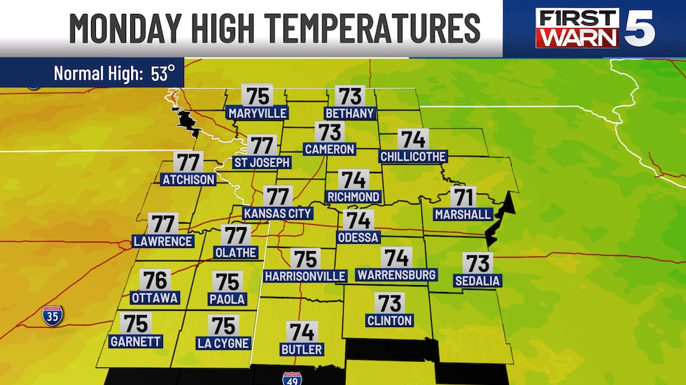
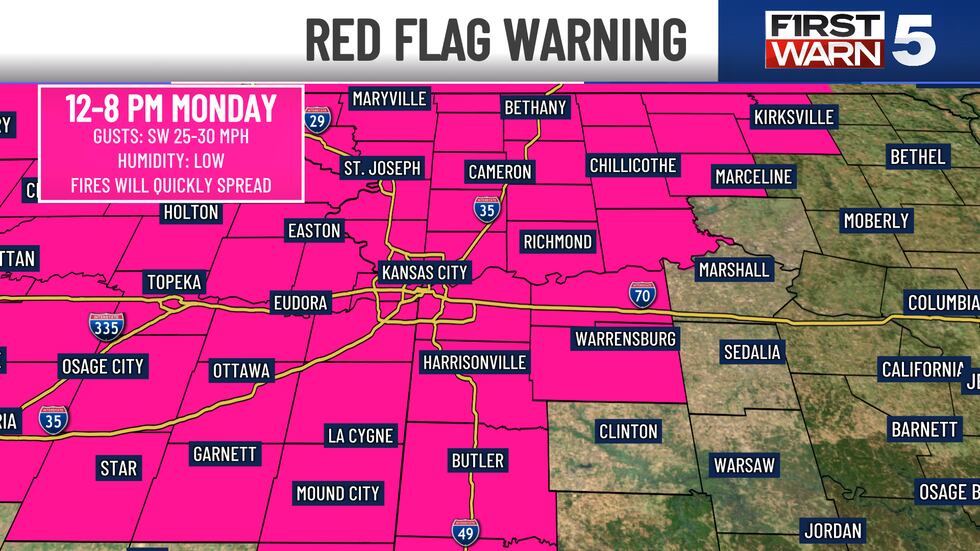
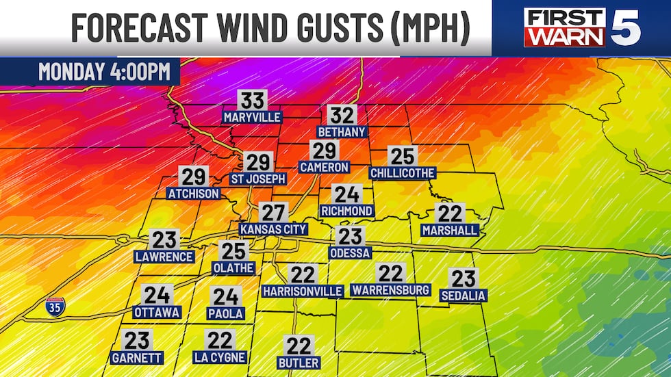
It’s hard to believe, but we will be even warmer Monday afternoon as temperatures take a jump into the mid to upper 70s. With the warmer temperatures comes a stronger wind out of the southwest. We could have gusts in the 20-30 mph range. Those gusty winds, partnered with very dry air in place, will allow for high fire danger. Any sort of fire will have the ability to get out of hand quickly. There is a Red Flag Warning (high fire danger) from 12-8 PM on Monday.
We have a weak cold front that comes in Tuesday morning and stalls out overhead. This should bring us back down into the 60s for highs. We keep a good deal of sunshine through the middle of the week, with temperatures feeling like spring!
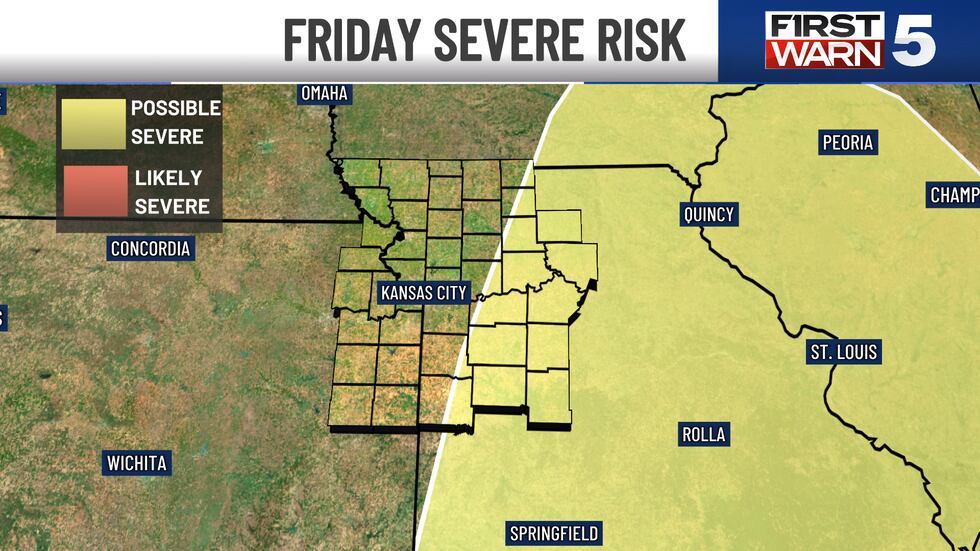
NEW - First Warns have been added to the forecast for Friday and Saturday as we are watching for our next large storm system to come through the region. Strong winds will keep temperatures in the 70s on Friday, but as an approaching cold front comes in from the west, a few thunderstorms could develop Friday afternoon. Ingredients are there for a few of the cells to be on the stronger to severe side. This is likely going to be more miss than hit, but a few communities have the chance for getting strong storms from Friday afternoon into Friday evening before the front drops temperatures. This is something we will be closely watching. Saturday morning will have plummeting temperatures. The high on Saturday is likely at midnight as the strong west wind drops us into the 40s for most of the day. For the most part, Saturday should be drying out after the early morning. Sunday looks quiet next weekend and temperatures will stay in the 50s.
Copyright 2025 KCTV. All rights reserved.


