Beautiful weather early this week, showers return Thursday with a First Warn for Friday
KANSAS CITY, Mo. (KCTV) - The cold front responsible for our severe weather is now south of those counties. A severe storm pounded parts of Henry County with hail nearly baseball size in La Due. AT 2:45pm there was no storm. By 3:18pm it rapidly developed into a severe thunderstorm, only 33 minutes!
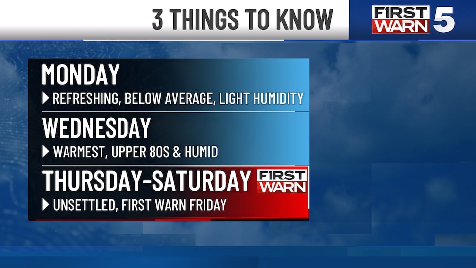
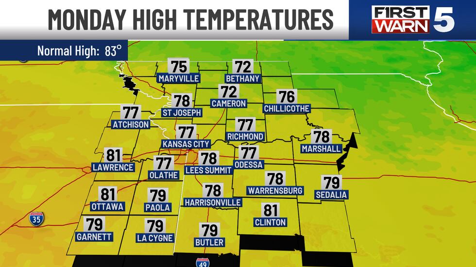
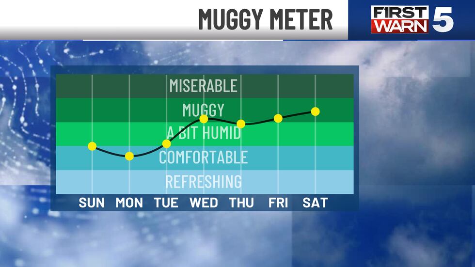
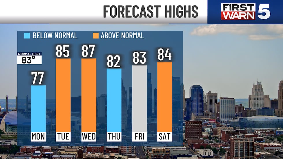
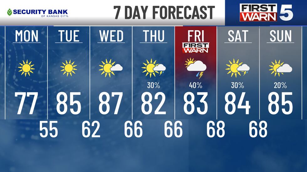
Moving forward, this cold front is freshening up our air. Monday looks amazing with below average temperatures and humidly. A bout of free air conditioning from our coolest day this week. Tuesday looks pretty nice also. Humidity stays low while highs warm back to average, middle 80s.
Warm muggy air returns from the South Wednesday. You’ll notice the difference, especially with highs in the upper 80s. A series of storms taps into this more energetic air and keeps unsettled Thursday, Friday and Saturday. Expect a several rounds of showers and storms. Good news, no hints of severe weather. A First Warn for Friday remains for our strongest and most impactful storms. Drier air moves in for Sunday.
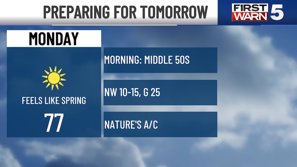
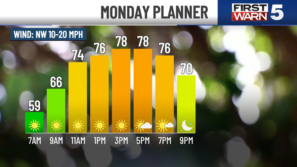
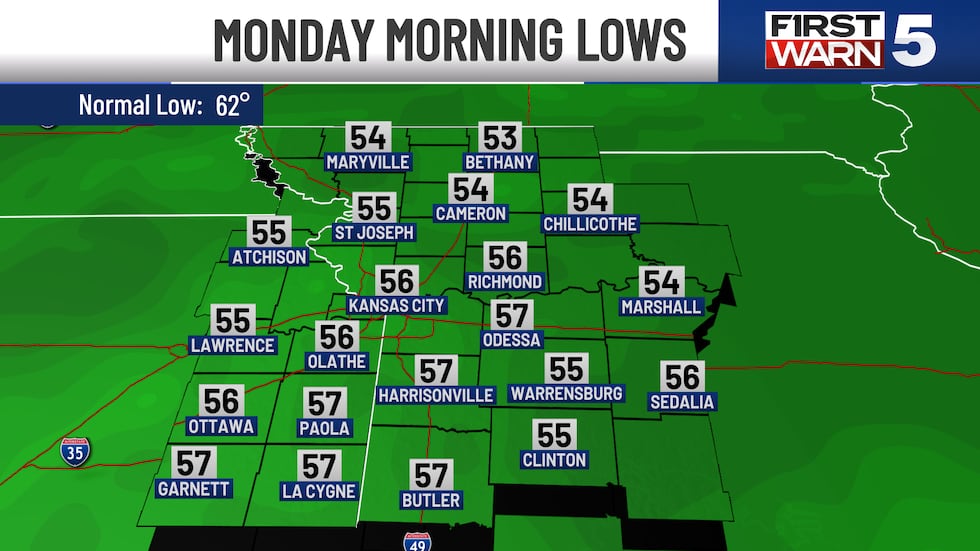
MONDAY: Sunny and comfortable. Lows in the middle 50s, highs in the middle 70s. A little breezy, though, NW 10-15 mph with gusts to 25 mph.
TUESDAY: Sunny and warmer with humidity staying in the comfortable zone. Lows n the upper 50s, highs reach the middle 80s.
WEDNESDAY: Warm and sticky with increasing clouds and breeze southerly winds, 10-20 mph. Our morning mostly sunny morning turns into a partly cloudy afternoon.
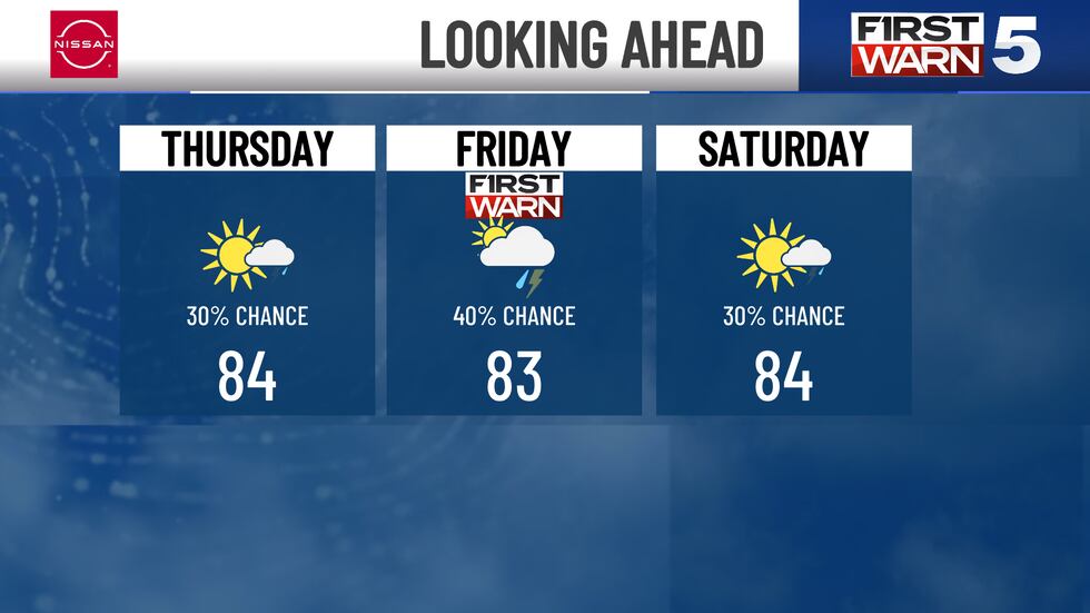
THURSDAY, FRIDAY AND SATURDAY: Unsettled weather brings a 30% chance for showers and storms Thursday, 40% Friday, and 30% Saturday. These are not lost days. Plenty of dry time to be outside. Lows only cool into the upper 60s, highs warm into the middle 80s.
To get the latest weather updates sent to your phone, the KCTV5 Weather app here.
Copyright 2025 KCTV. All rights reserved.