FIRST WARN FORECAST: Pleasant weather again Tuesday with warmest day of year possible Wednesday
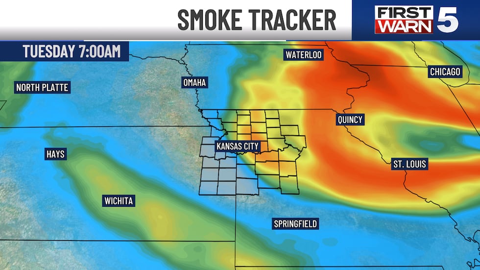
Another pleasant day is on tap for Tuesday. A refreshing morning awaits with temperatures in the mid-50s. Strong sunshine warms the last day of dry air nearly 30° tomorrow! Our usual spread is 20°. Lingering smoke from Canadian wildfires moves east during the afternoon, giving us a less murky afternoon and evening sky.
Summer warmth and humidity surge back into our neighborhoods Wednesday. Our first 90° day is in reach. If not Wednesday, plenty of more chances next week during a long stretch of warmer-than-average temperatures.
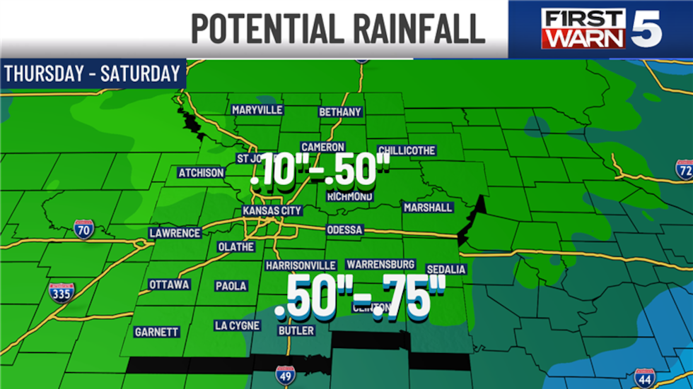
Seasonally warm and humid conditions return Thursday, Friday and Saturday. This also coincides with our next chances for showers and storms. These chances look fairly low, between 30% and 40%, and not severe. At this time, Friday looks to be impacted the most, prompting the First Warn for Friday.
TUESDAY: Hazy sunshine with a large temperature spread, middle 50s to middle 80s. This will be our last cool morning. Winds will be light and from the south.
WEDNESDAY: Partly cloudy, warm and humid. Morning temperatures mirror average levels, middle 60s. Highs warm to near 90° with heat index values, what it feels like, near 95°.
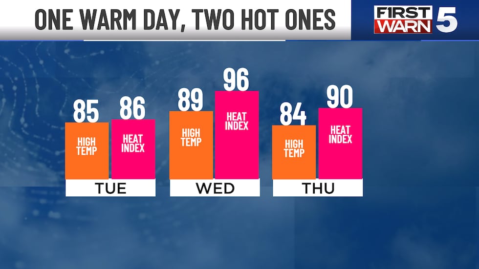
THURSDAY: Partly cloudy with a 30% chance for showers.
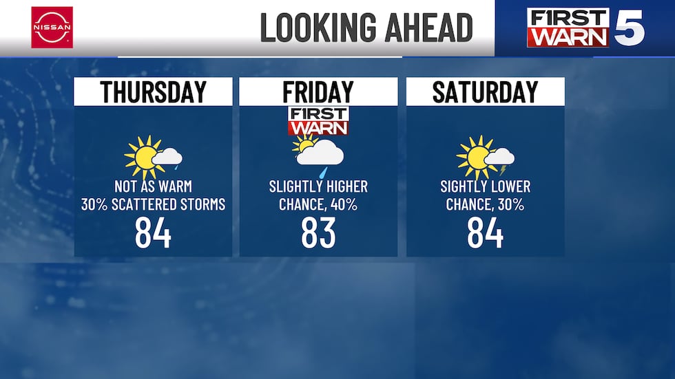
FRIDAY: Partly Sunny with a 40% chance of showers. At this time, they may clear out before evening.
SATURDAY: Partly cloudy, lower chance for showers, 30%. All three days feature lows in the upper 60s and highs in the middle 80s with near 90° feels-like temperatures.
SUNDAY (Father’s Day): Trending drier and warmer, middle to upper 80s.
Copyright 2025 KCTV. All rights reserved.