FIRST WARN FORECAST: Spots of downpours before a steamy Father’s Day Weekend
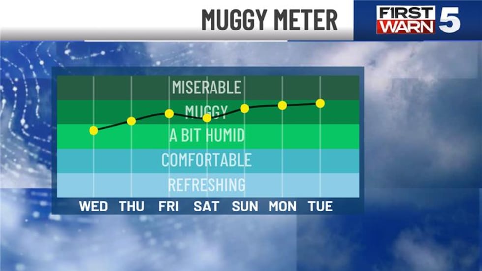
KANSAS CITY, Mo. (KCTV) - Wednesday went down as the hottest day so far in 2025, though we fell short of the 90s with a high of 88. The rest of the week will be less hot with highs in the low 80s, but the humidity may actually increase a bit. With the high humidity now firmly established, it will be easy to touch off spotty showers and a few thunderstorms both Thursday and Friday. Neither day looks to bring widespread rain, but rather isolated (but potentially briefly heavy) rain.
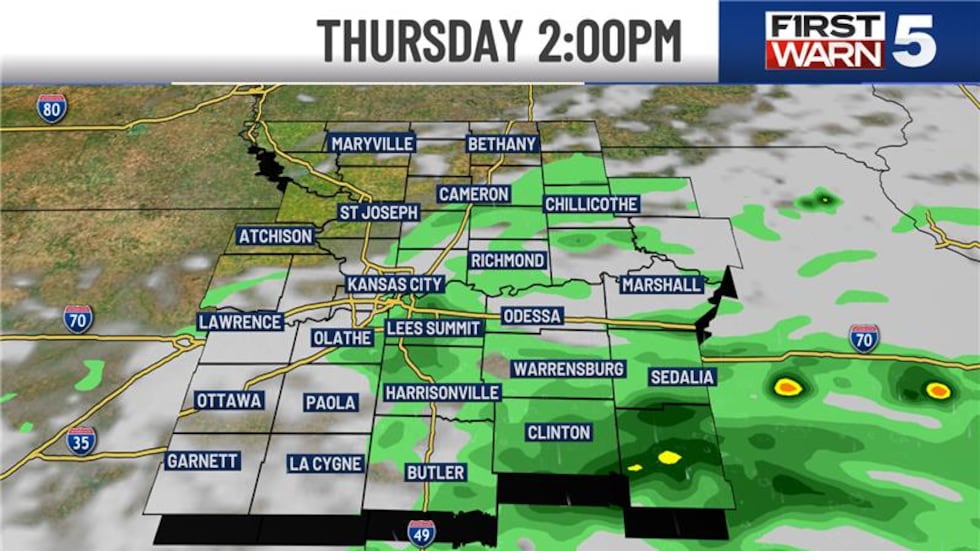
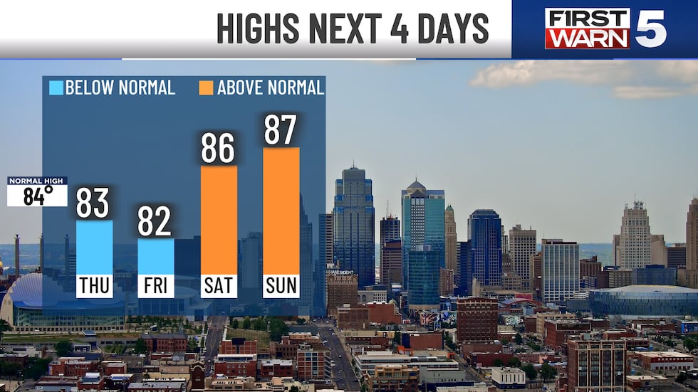
THURSDAY: Warm and dry in the morning with temperatures near 70. Thicker clouds hold the afternoon highs to the low-mid 80s. Spotty afternoon downpours will be around, with any one spot having a 30% chance of getting one.
FRIDAY: More spotty downpours are possible in the morning and early afternoon, with drier conditions expected after 3 pm. Highs will be in the low 80s.FRIDAY: More spotty downpours are possible in the morning and early afternoon, with drier conditions expected after 3 pm. Highs will be in the low 80s.
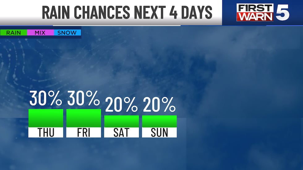
FATHER’S DAY WEEKEND: Lots of good dry time to be outside, though the heat will pick back up with highs in the mid to upper 80s. The heat index will range from 90 to 95. The rain chance is slim at 20%, but a few spotty showers or brief thunderstorms are possible.
Copyright 2025 KCTV. All rights reserved.