Spotty downpours with cooler conditions today
KANSAS CITY, Mo. (KCTV) - A significant cool-down will be felt today, but humidity levels remain high. Humidity will help build in spotty rain & thunderstorm chances today. We keep the low-end rain chances throughout the weekend, but temperatures rise once again.
Spotty rain chances will travel up the eastern side of the I-35 corridor this afternoon and exit around 6 pm. The best chance for rain in the metro is from morning to lunchtime. We are mainly going to see some rain showers, isolated heavy downpours, and maybe an isolated thunderstorm.
This morning will be cloudy, humid, and warm. We will see temperatures starting in the upper 60s to the low 70s. We struggle making it to the mid-70s by lunchtime. The cloud cover, humidity, and rain chance will cause temperatures to be on the cooler side. Highs struggle to reach 80°, but with the humidity, may feel as warm as 85°.
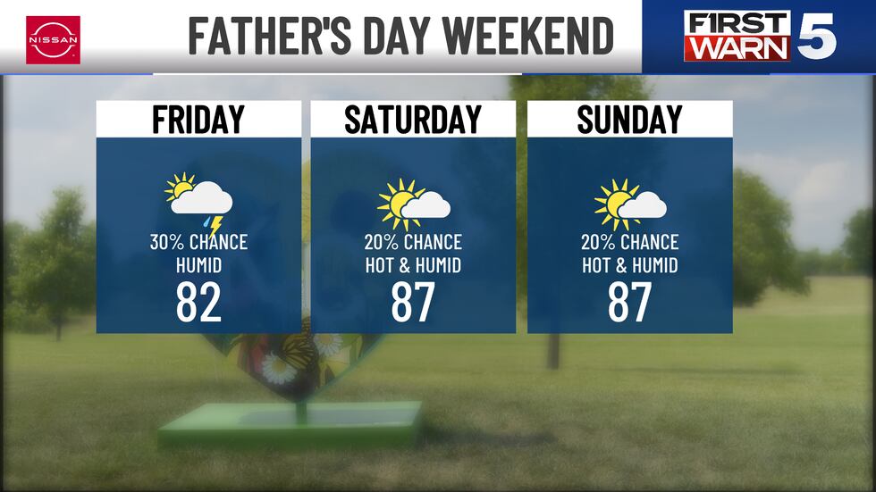
FRIDAY: More spotty light rain showers and some downpours are possible in the morning and early afternoon. We should dry out later in the afternoon and evening. Highs will be in the low 80s and paired with humid conditions, making feel-like temperatures in the mid-80s possible.
FATHER’S DAY WEEKEND: Lots of good dry time to be outside, though the heat will pick back up with highs in the mid to upper 80s. The heat index will range from 90 to 95. The rain chance is slim at 20%, but a few spotty showers or brief thunderstorms are possible.
To get the latest weather updates sent to your phone, the KCTV5 Weather app here.
Copyright 2025 KCTV. All rights reserved.


